Plot on satellite
See your plot on a satellite map by address
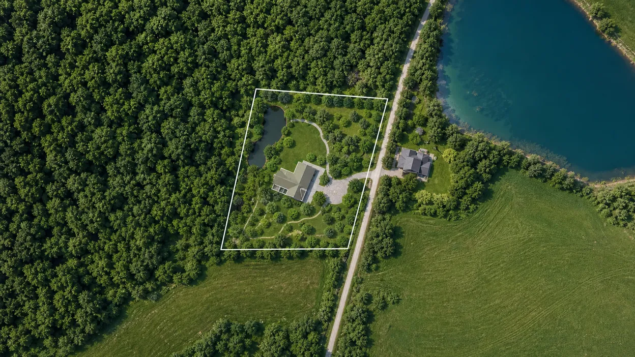
Open a live satellite map right under your plot plan, find your place by address or cadastre number — and design straight away, seeing the real surroundings: forest, ponds, fields, the road and neighbouring plots.
Turn on the map underlay and find the place by address.
Check the plot boundaries and what is around it.
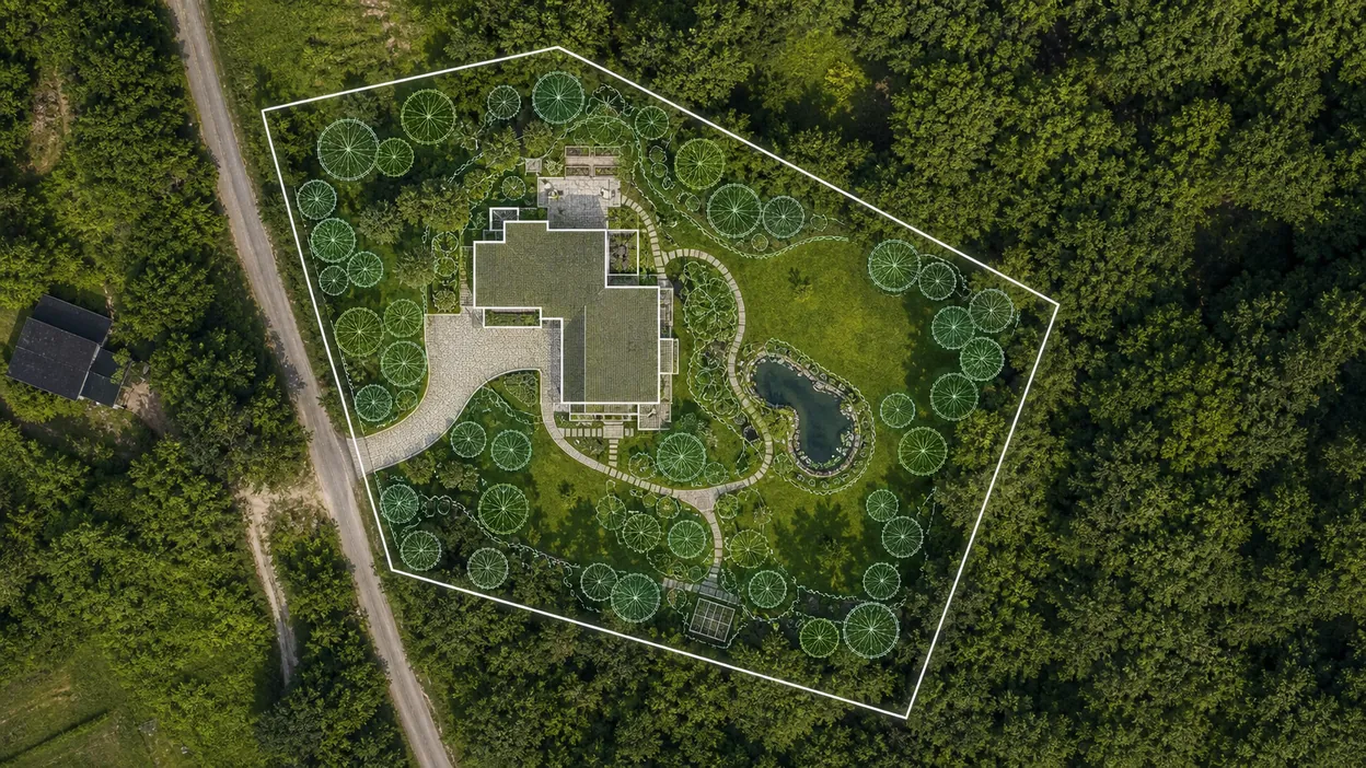
Plan the house and buildings right on the satellite.
How to find a plot on a satellite map by address or cadastre number
In the gardmi planner you can turn on a live map under the drawing — satellite, hybrid (imagery with street labels) or scheme. These are Yandex and Google maps, so the imagery is fresh and detailed: you can make out individual trees, paths and structures.
- Open the editor and click the “Map” button at the bottom left.
- Pick the place. Type the address in the search — the map flies to the right spot. The scale is set automatically so you can start drawing at once.
- Or import by cadastre number — gardmi pulls the exact plot boundaries from the public cadastre.
After that the satellite image stays as a background underlay: you draw the plan over the real terrain, and only the coordinate anchoring is saved in the project — the map tiles themselves are not stored.
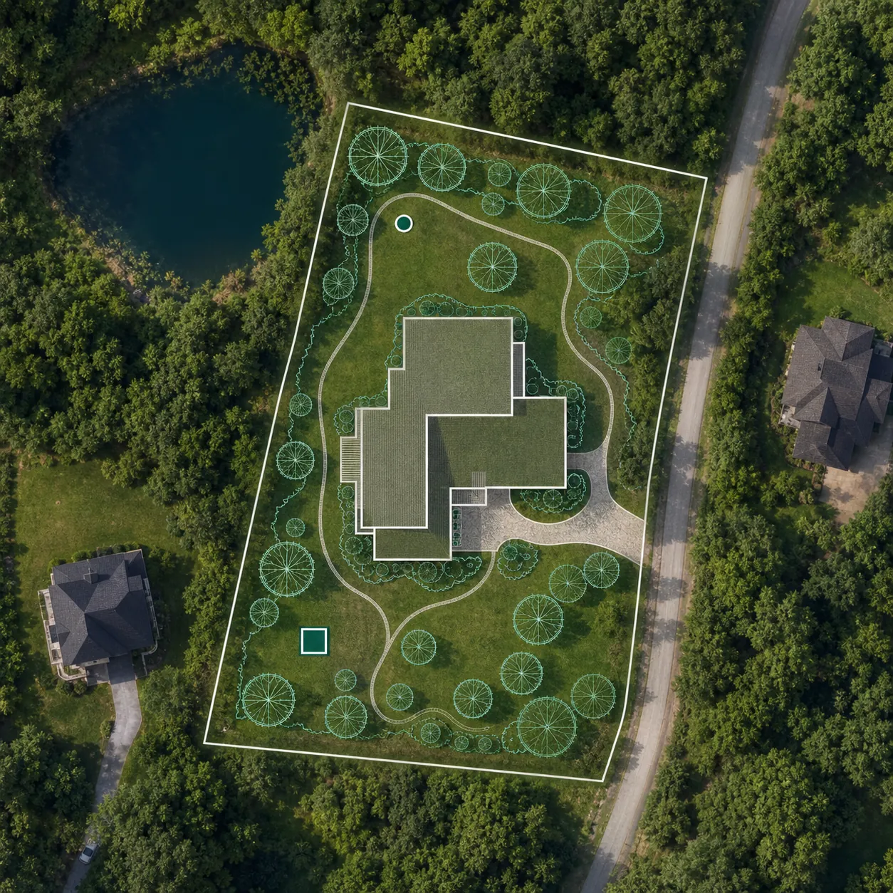
Plot boundaries and cadastre from satellite
So the plan does not drift, it is important to rely on the real boundaries. gardmi has two ways to anchor the plot to its real location:
- By cadastre number. The plot outline loads from the public cadastre map and lies over the satellite image — you can see whether the actual fences match the cadastre boundaries.
- By address and imagery. If you don't have the number at hand, find the plot by address and trace the boundaries straight on the satellite, using fences, edges and corners as guides.

The satellite image shows the actual position of objects, while the cadastre shows the legal boundaries. Combining them in one plan helps you spot discrepancies before construction begins.
What you see around the plot: forest, water, neighbours and the road
The main benefit of satellite for planning is seeing not only your own plot but everything around it. That changes decisions about where to put the house, the leisure zones and the utilities.
| What you see from satellite | What decision it helps make |
|---|---|
| Forest, lake, river, field | Place the house and gazebo facing the water or forest — view zones |
| Neighbouring plots and buildings | Plan setbacks and privacy, no overlooking the neighbours |
| Road and entrance | Choose a convenient spot for the gate, parking and driveway |
| Lowlands, streams, terrain | Tie the well, septic and drainage to the water and the slope |
| Existing trees | Decide what to keep and what to clear for building |
Plan the plot right on the satellite map
Satellite in gardmi is not just “look” — it is the basis for the project. Over the real image you draw a plan at true scale: metres on the map equal metres on the ground.
- Trace the plot along the boundaries from satellite, or import it by cadastre.
- Place the house and buildings with the cardinal directions, the views and the setbacks from neighbours in mind.
- Add the well, septic and utilities — sanitary zones are drawn automatically, violations are highlighted in red.
- Check it in 3D and save the project online or share a link.
A plot scheme for a sale: a satellite photo for the listing
Before a sale, a plot is almost always photographed from satellite — it is the key image in the listing: the buyer wants to see at once where the plot is, what its boundaries are and what is around it. But a plain map screenshot doesn't answer every question.
In gardmi you can make not just an outline by cadastre number, but a clear plot scheme for the listing over the satellite image, and mark on it everything that matters to the buyer:
- Entrance and access — where the gate is and how to drive in from the road.
- Cardinal directions — where the sunny side is and where the house windows will face.
- Utilities — gas, electricity and water at the boundary, the spot for a well and septic.
- What is nearby — lake, river, forest, bus stop, shop, school — with distances in metres.
- Landmarks and points of interest — notable places nearby that make the plot easy to find.
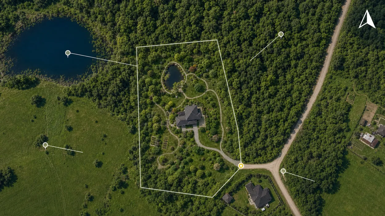
Such a scheme makes the listing stand out among a dozen identical ones: it answers the buyer's questions in advance, shows the plot's potential and looks professional. The finished plan can be exported to PNG or PDF and attached to the listing or sent to the buyer in a messenger.
See your plot on a satellite map for free
You can open your plot on satellite and start planning right now, with no software to install and no sign-up. Find your place by address, see what is around, and draw the plan on a real map.