تصريف سطحي
Channel drains with grates, point catch basins under the downspouts and a collector pipe carry rain off paths, the driveway and the roof to an outlet.
خطّط تصريف أرضك عبر الإنترنت. ارسم أنابيب التصريف والقنوات السطحية والآبار مباشرة على خريطة قمر صناعي — يربطها gardmi في شبكة واحدة، ويضع عقدة عند كل تقاطع، ويظهر الميل وعمق كل بئر، وينبّه أين لن يتدفّق الماء.
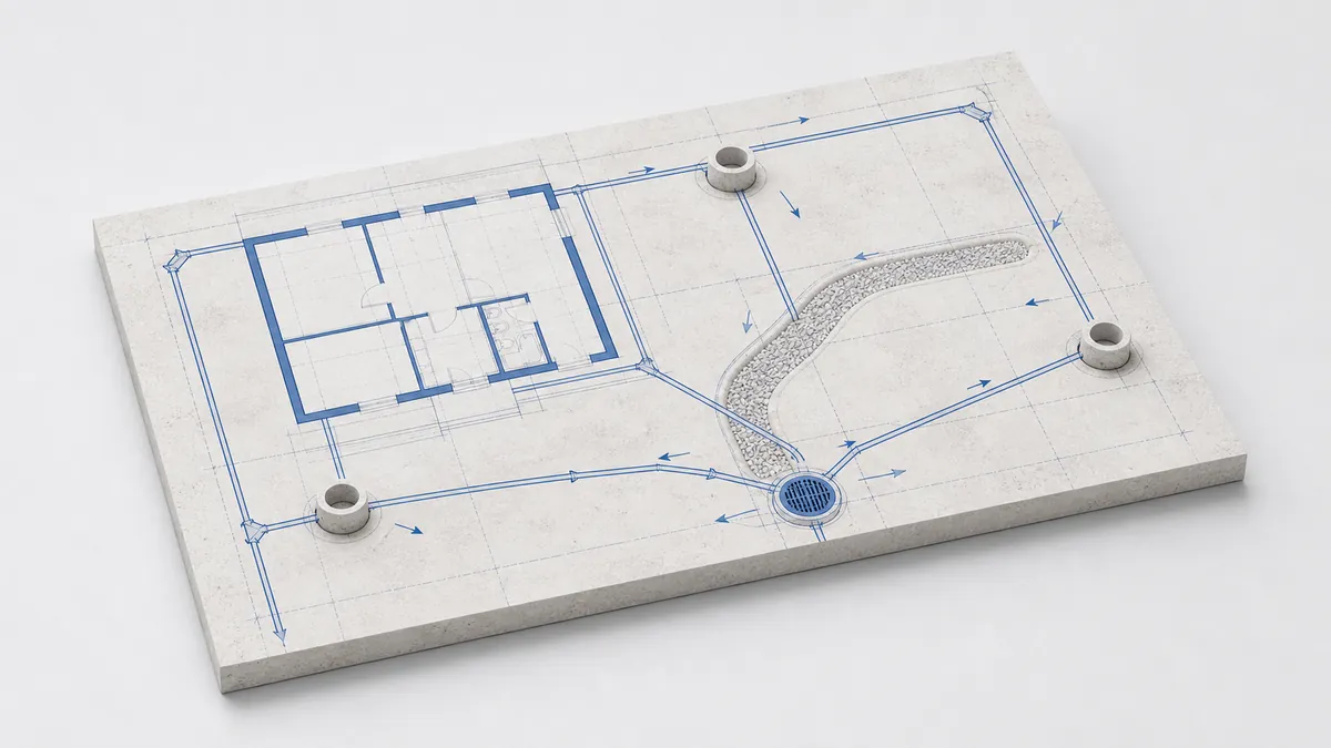
Channel drains with grates, point catch basins under the downspouts and a collector pipe carry rain off paths, the driveway and the roof to an outlet.
Perforated pipes in a gravel trench lower the groundwater table and keep the foundation and the garden dry — wall, ring or herringbone layouts.
Linear drainage is a continuous channel along a path or wall; point drainage is a single inlet at a low spot. Both feed the same collector network.
A french drain is a perforated pipe wrapped in gravel and geotextile; a swale (dry creek) is a shallow stone-lined channel that slows and soaks the runoff.
A drainage system is a few standard parts. The pipe carries the water; wells let you inspect, turn and join runs; an outlet or a soakaway is where it all discharges.
Perforated pipe (Ø110) for groundwater, or a smooth solid pipe (Ø110–160) for stormwater. In gardmi each run carries its own diameter, slope and material.
Put an inspection or turning well at every junction, bend and diameter change, and at least every 20–50 m on a straight run, so the line can be cleaned.
The network must end somewhere: a soakaway pit that lets water seep into the soil, or an outlet into a ditch or storm sewer. gardmi warns if a network has no outlet.
A catch basin is the point inlet under a downspout; a sand trap holds back silt before the pipe so it does not clog. Both sit right on a channel run.
Open your plot on a satellite map and mark where water collects — by the house, along the fence, at the gate. Water has to run downhill from there to an outlet.
Pick a pipe or channel and click along the route; where two lines cross, gardmi drops a junction automatically. Add inspection wells, a catch basin or a soakaway as the network nodes.
Each run shows its slope and a flow arrow toward the outlet. gardmi computes the depth at every well and highlights a run that is too flat or sits above the frost line.
Pipe metres and the number of wells turn into a cost estimate in your currency, ready to export with the plan to PNG or PDF.
Pipes, channels and wells form one graph. Cross two lines and a junction appears; drag a well and the connected pipes follow.
Every run is drawn at its true width, so you see how much space a channel or trench takes — with the grate, gravel or stones on top.
The planner checks that every run flows downhill at a workable slope, lies below the frost line, and that the network actually reaches an outlet.
Pipes are priced per metre and structures per piece, summed into an editable estimate; export the plan over the satellite image to PNG or PDF.
Two families: surface drainage (channels, catch basins and a stormwater collector) and subsurface drainage (perforated pipes in gravel that lower the groundwater and protect the foundation). Most plots combine both.
Drainage works by gravity, so every run must fall toward the outlet — about 0.5% for a perforated drain (5 mm per metre) and up to ~2% for a storm pipe. gardmi shows the slope on each run and flags a pipe that is too flat to flow.
A buried drain should lie below the frost line for your region (about 1.4 m in central Russia) and gets deeper toward the outlet as the slope accumulates. gardmi computes the depth at every well and warns if a run sits above the frost line.
Yes. Each run is priced per metre and each well, catch basin or pump per piece; gardmi sums them into an editable project estimate in your country's currency.
gardmi مخطّط مجاني عبر الإنترنت. الأرقام هنا إرشادية — راجع الأنظمة المحلية لمنطقتك.